Mapping the White Castle/Krystal Divide
Ahh White Castle. I’ve had a love/hate relationship with this place since college. Sometimes after a solid night of pillaging and conquering, nothing satisfies your hunger like those little square, steamed devil burgers. Give me a ten sack and life is good. Add in some tots and a side of ranch? Game over. Good night. As for Krystal, I had it once on the way to Panama for Spring Break. It was alright… And that’s the end of that story. Anyway, I always had this vague idea that White Castle was only in the north and Krystal were in the south so I decided to map it out.
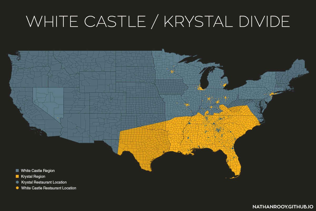
Looks like my initial assumption was fairly correct. Krystal does seem to be the southern alternative to White Castle.
Notes:
The White Castle and Krystal locations were scrapped off Google Maps using a Python script I wrote and dumped into an SQL database. This resulted in 354 Krystal locations and 405 White Castle locations. From here, I imported the latitude/longitude locations into QGIS as a CSV layer along with the county level base map from the U.S. Census. I then created the voronoi and finished the map in Photoshop. If you’re wondering why their are two different shades of blue and yellow it’s because the states that actually include a White Castle/Krystal restaurant are the lighter shade. The darker shade of blue/yellow are reserved for states that are merely within a White Castle/Krystal region but don’t actually include a White Castle/Krystal restaurant. There is a single White Castle in Las Vegas, hence Nevada’s lighter shade of blue.