Cincy to Dayton and Back by Bike / My First Century!
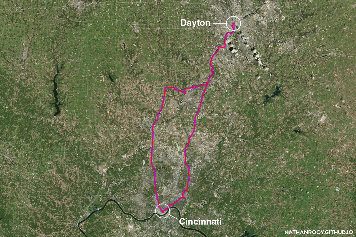
Since I had some time off recently, I decided to finally try and bike to Dayton and back in one day. I bike everyday to and from work, so the idea of biking long distances simply to log miles isn’t that appealing to me. I’m not some suburban spandex wearing weekend warrior with a bike rack on my car. Still, the challenge has taunted me for a while and it sounded fun. So, at the precise time of 10:47am wearing a hoodie and shorts I packed a gallon jug of water in my backpack and set off. After circling Fountain Square, I rode on Central Park Way up to Northside and took Hamilton Ave out to the sticks…
Below, I created a map using QGIS and the GPS output from Strava which was running on my phone during the entirety of the trip.
Since I had the GPS time series data dump in the form of a CSV, I ended up doing a little analysis. Using the Haversine formula I could calculate the distance between two latitude and longitude points giving me distance traveled and subsequently velocity. Implementing this in a quick Python script along with matplotliband Seaborn I was able to create the plots below.
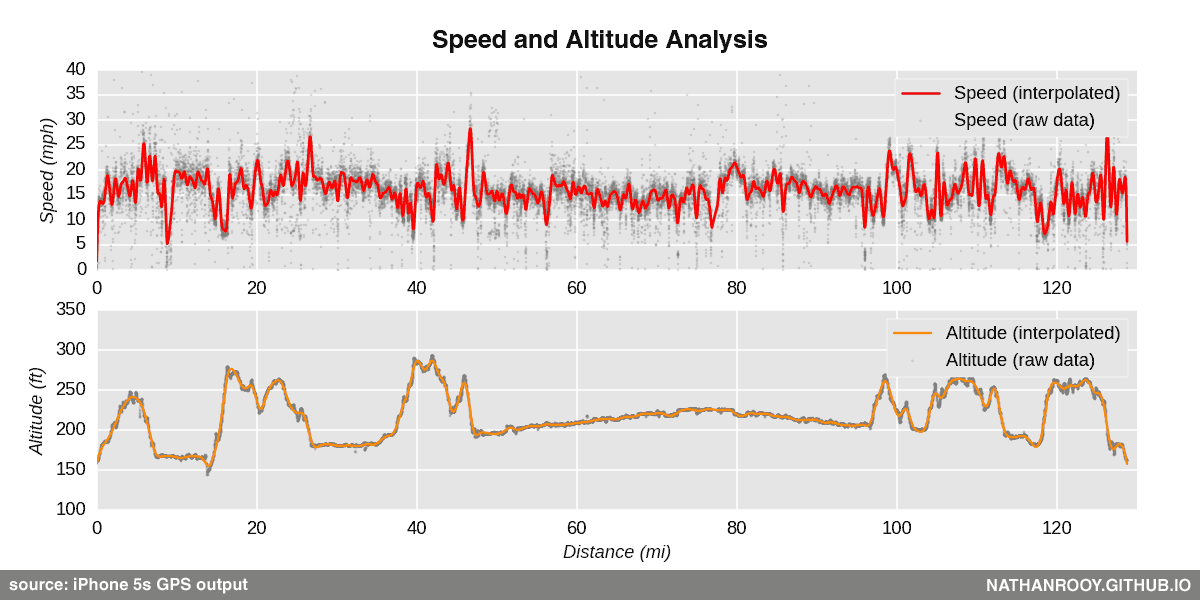
Because the velocity point data was fairly noisy and the duration of the trip was so long, I ended up employing the univariate spline interpolation from SciPy to simplify the output a bit. That’s why there is both a line and point data for each plot.
Overall, it wasn’t that bad. At just over 128 miles, it took a little longer than I thought, but I got to enjoy some great scenery!